This past Saturday afternoon took me to
Port Moody by a combination of bus, then train and then a bus once more (B-97). Then I walked to the start of the
Coquitlam Crunch Trail in neighbouring
Coquitlam. It turned out to be a much nicer day than I had originally imagined. It was bright and sunny, not to mention very warm. It was so warm that I took off the t-shorts I was wearing. I didn't need them, nor did I need the sweater I brought along in case it was cool. Part of the trail was sponsored by someone named "
Mr. Bear." I saw neither Mr. Bear nor the furry creature, so all was well. Anyway, the weather was peerfect!


Going up the trail there are some courts of one description or another. The one pictured was used to play a sort of field hockey.


Raspberries and such are in season. Canes are found in many places. The photo above gives you an idea. Then the rules were posted for the safety of those using the
Eagle Ridge Greenway.


The photo above looks south and the one below shows a bee visiting a buttercup (flower).

 Rugosa-type roses
 are to be found with plenty of flowers or buds about to open and the rose hips that I found are large and plentiful.


Another wildflower to be seen is the
Goldenrod, a sign that autumn is getting close. There is a close-up of a
bee visiting one above and then a grouping growing along the trail in the photo below. The yellow blooms look lovely against the blue sky.


There is tall
grass dried from the recent dryness plus
vetch and
crown vetch grow in the grass as well.


That's
Yarrow in the image above and a view of the
Golden Ears Bridge across the Fraser River in the photo below.


There is another field and a lovely view plus a photo of
daisies in bloom on a hillside in the photo below.


I found a clump of
Western Pearly Everlasting (
Anaphalis margaritacea var. occidentalis) growing at the base of a tower. Below is a close up shot of one of them.

 Eagle Mountain
 is off in the distance. Below is a shot of one of the mileage and elevation markers along the trail. The one shown was the last one at the end of the
Coquitlam Crunch Trail.


I encountered several guys on motorbikes and trail bikes during the hike up the mountain and back down. On the way down I encountered a group of three I had seen earlier plus one other that stopped to ask permission regarding biking on the trails, then yet another before I made it back to the road.

There are all sorts of wildflowers along the trail if you take a careful look (see above).
Eagle Mountain is ever closer as I proceed further up in elevation.


Thistles are associated with summer time and as I hiked up there were more and more of the
Western Pearly Everlasting to be found along the trail.


There was moss-encrusted rock along the road. Below is a close-up shot.


It wasn't all
Western Pearly Everlasting. I found some
yarrow growing along the road and trail as well. Something that caught me by surprise was finding the bed of a railway freight car along the trail. I keep finding surprising things. Now how did that get there?


I encountered three streams on the hike. The one pictured is just one of the three.


Again, I couldn't get over the weather. We normally get such weather much earlier in the summer, but not this year.
Huckleberries are in season now. A bush is show below and a close-up of the berries below that. The shrubs are related to the
blueberry. I was nibbling on them as I hiked along.


A short trail is shown in the photo above. It lead to a wonderful surprise, a beautiful
vantage point to see the area from the height of
Eagle Mountain.


That vantage point is near a microwave tower. And again, lots of the Western Pearly Everlasting are to be found.


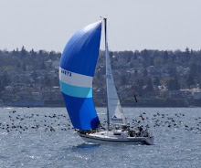
There was another vantage point looking west, southwest. Here you see
Burrard Inlet, then downtown
Vancouver and
Stanley Park plus
English Bay behind that. The photo below shows where
Indian Arm meet
Burrard Inlet at
Burnaby Mountain (looking southwest).


The above photo looks west toward the mountains around
Buntzen Lake. There is
fireweed as well (below).


I had intended to hike to
Eagle Bluff (image above). There is a view of
Buntzen Lake from there but time ran out and I had to turn around to return home. There will be another attempt on the
Labour Day weekend.


Then there are
fish habitat signs posted, in this case regarding
salmon!


I saw a nurse stump on the way back down that I had missed on the way up and on the road I found this big black slug crawling along! Enjoy the photos and feel free to comment or ask any questions! - V

 Normally, I start hiking in May and keep going through the summer. With the mini-stroke I had in early May this year, things were delayed but I've done the best I can with the season that is left. Seeing the view from Eagle Bluff last weekend has been inspirational but do some homework before you go out hiking, where ever you are!